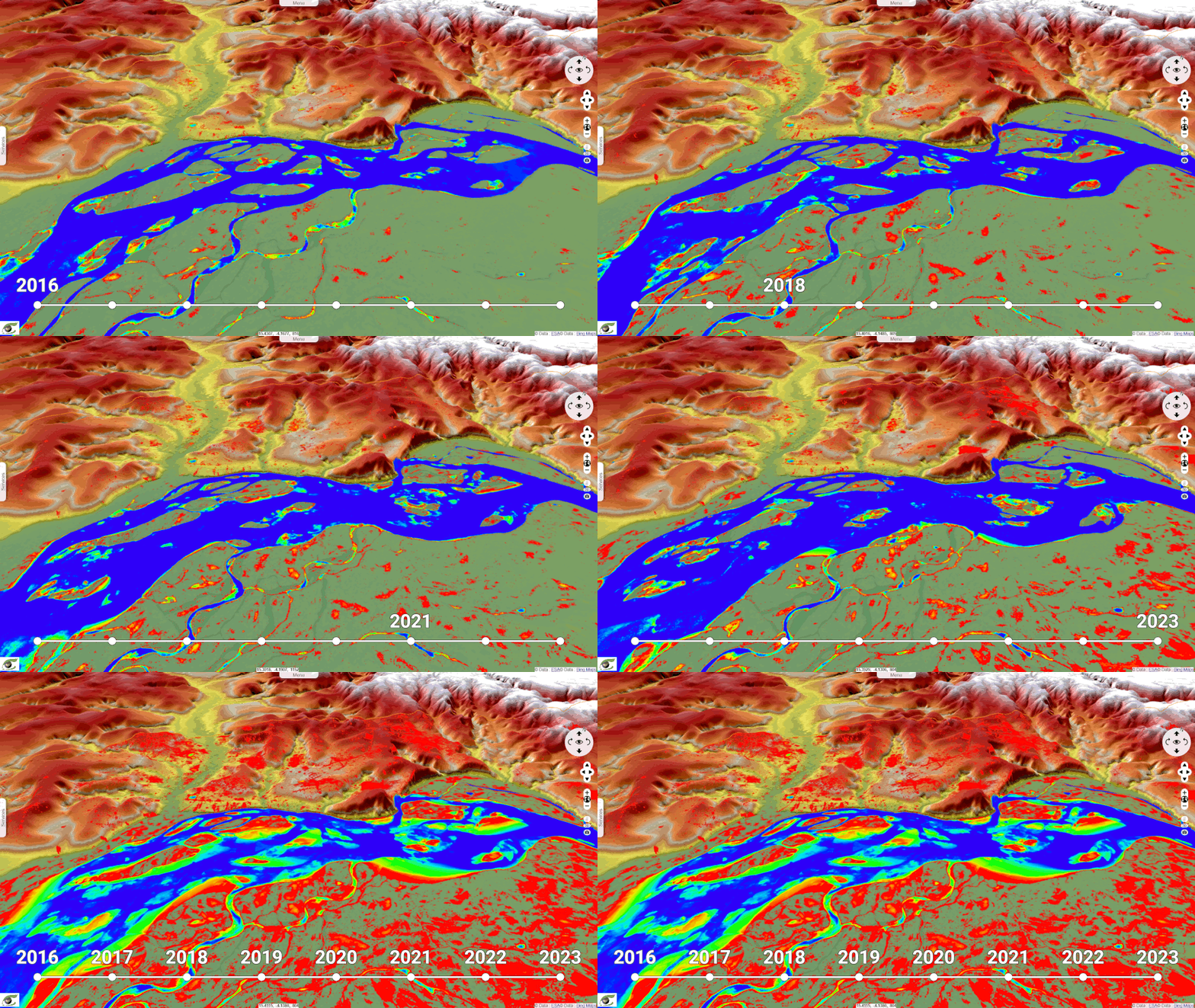
This geoservice presents a map of water zones in the Congo Basin, automatically detected from a radar image acquired on August 18, 2020. This map uses a color scheme to differentiate permanent water zones from areas at high risk of flooding.
Color Scheme:
Blue : Permanent water zones
Red : High flood risk areas
Analysis and Results:
Permanent Water Zones (Blue): Represent bodies of water that are present year-round, such as lakes, major rivers, and perennial wetlands.
Importance : These zones are crucial for local ecosystems and the water supply for surrounding populations.
High Flood Risk Areas (Red):Based on recent precipitation and historical flood data.
Location : Include floodplains and regions near major rivers and tributaries.
Priority : These zones are prioritized for emergency interventions and disaster prevention plans.
Usefulness of the Data:
The information provided by this geoservice is essential for:
Crisis Management: Enables local authorities and rescue teams to plan effective interventions in case of flooding.
Urban and Environmental Planning: Helps make informed decisions for sustainable development and the protection of natural habitats.
Awareness and Information: Informs local communities about flood risks and the precautionary measures to take.
